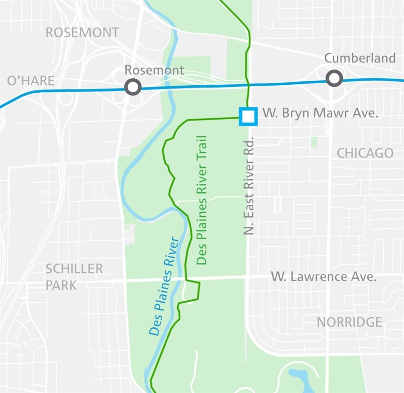
Des Plaines River
At Bryn Mawr
Ross Barney Architects
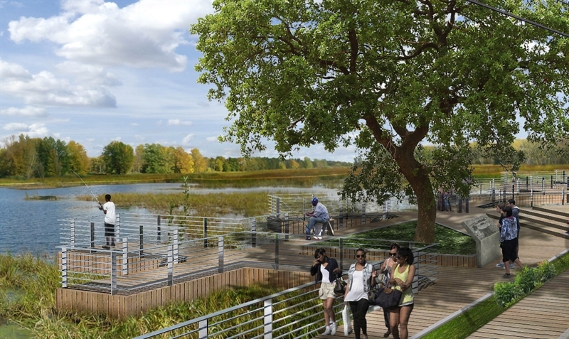
Hidden in plain sight, the Des Plaines River and a 56-mile trail wind through forest preserves among hotels, offices and homes in Chicago and suburbs.
Google
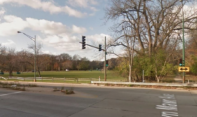
Now
Ross Barney Architects
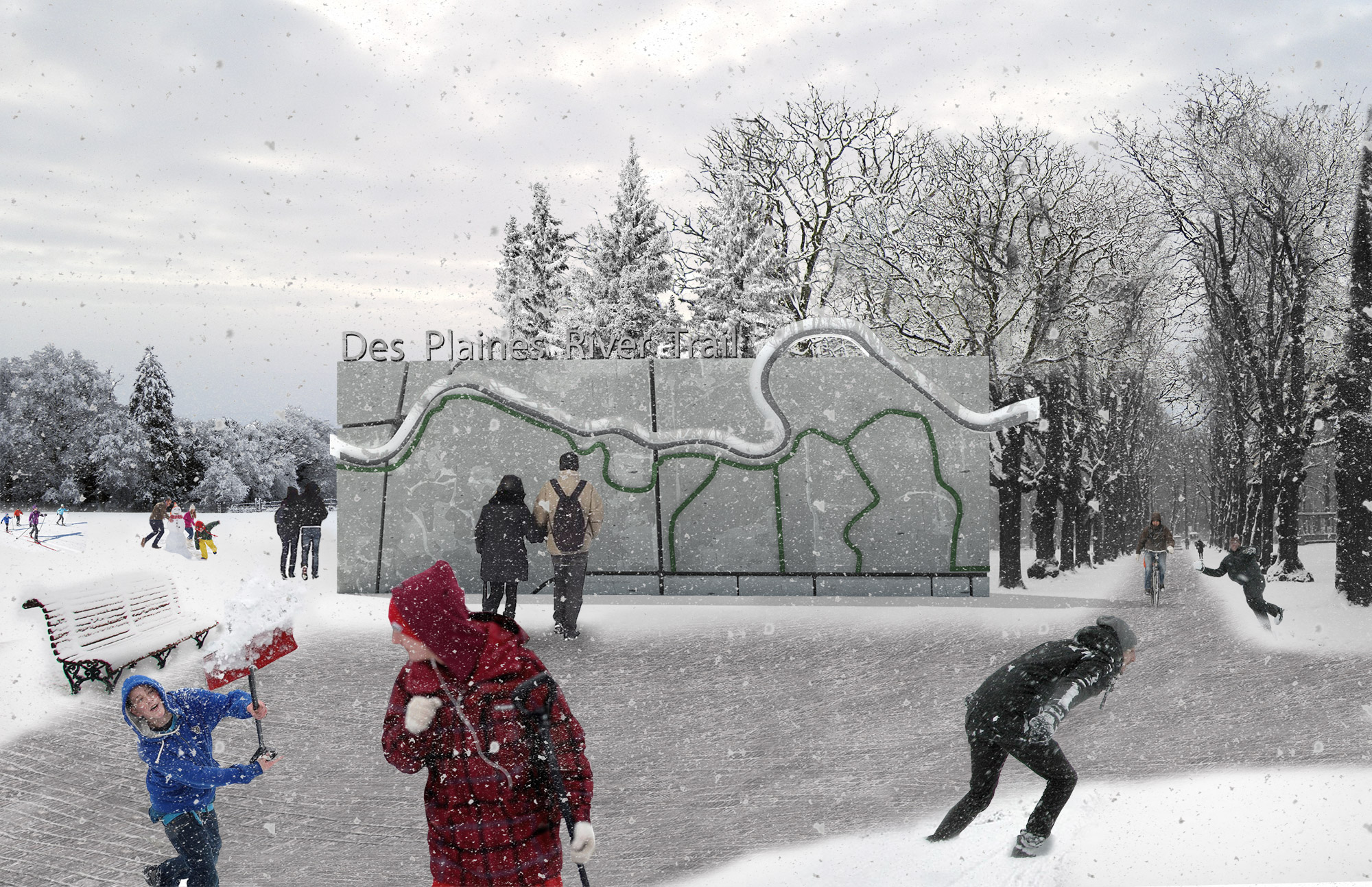
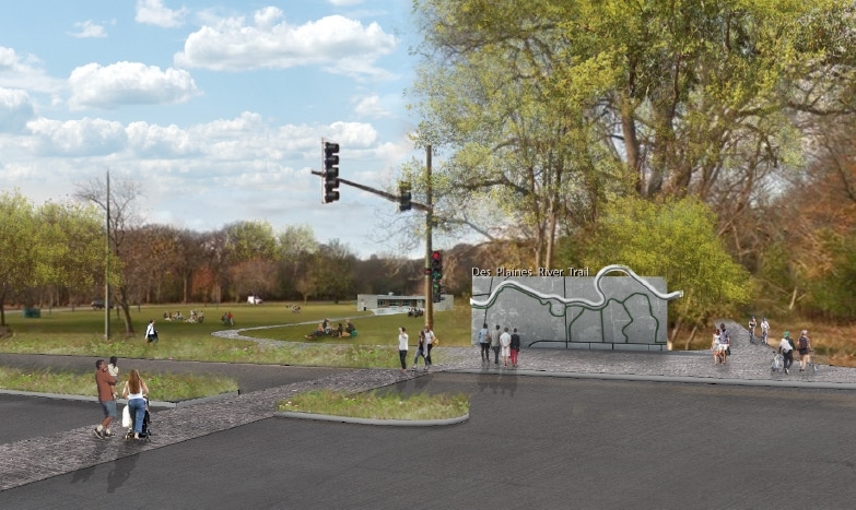
Future
The Des Plaines River Trail is accessible from Chevalier Woods, where Bryn Mawr ends at East River Road—but it’s hardly obvious. New signs, branding and improved pedestrian facilities will make the trail more visible and accessible to visitors.
 (Rendering above)
The Des Plaines River Trail will be well signed and well maintained
Nearby residents, office workers, hotel guests and weekend visitors from across Chicago and surrounding suburbs like Rosemont and Franklin Park will be enticed to escape to the natural environment of the forest preserve, trail and river.
Improved pedestrian access with clearly-marked crosswalks and signs, trail entrance kiosks and wayfinding from surrounding street grids, transit stations, office parks and hotels will foster easier connections between neighbors, neighborhoods and nature.
Clearly-marked access points will be frequent and inviting
Various points along the east and west side of the Des Plaines River would benefit from easy access by foot or by bike, facilitated by new investments in bridges and signage telling visitors where they are in the Des Plaines River and Trail system, and what amenities they can explore along the way.
Back to top
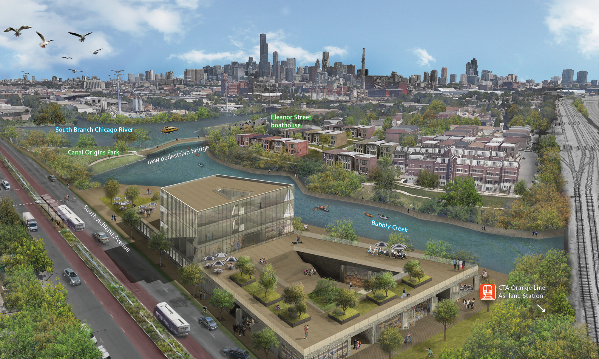
Ashland
At Bubbly Creek And CTA Orange Line
Ross Barney Architects
At the mouth of Bubbly Creek and the origin of the historic I&M Canal lies a dormant parcel that could become a riverfront destination and transit hub.
Ross Barney Architects
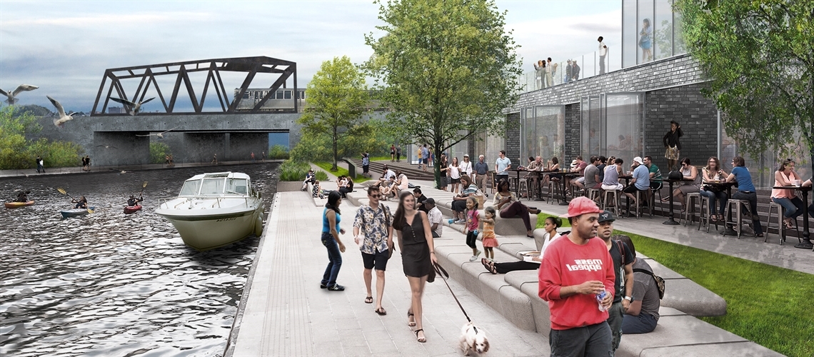
A mixed-use development will create a vibrant hub of activity
This vacant lot is a prime location for mixed-use development featuring housing, retail and riverfront recreational opportunities, and could serve as a model for other riverfront parcels.
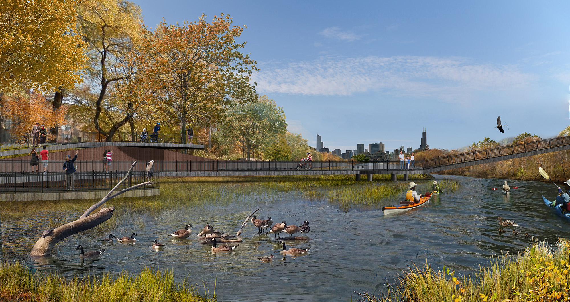
Imagine this as a potential gateway for residents, nearby employees and visitors alike to enjoy the surrounding river-oriented activities and amenities: birdwatching from Canal Origins Park, rowing from Eleanor Street boathouse, commuting via water taxi, or exercising along a new riverfront trail.
Improved access will draw people to the river
Improved pedestrian access and connections from the nearby Ashland CTA Orange Line station, buses on Ashland Avenue and 31st Street, and a water taxi stop would welcome residents of Pilsen, Bridgeport, McKinley Park, Chinatown and beyond to this historic place along the South Branch.
A new pedestrian bridge over Bubbly Creek will improve access to and from the part of Bridgeport on the east side of the creek.
Back to top
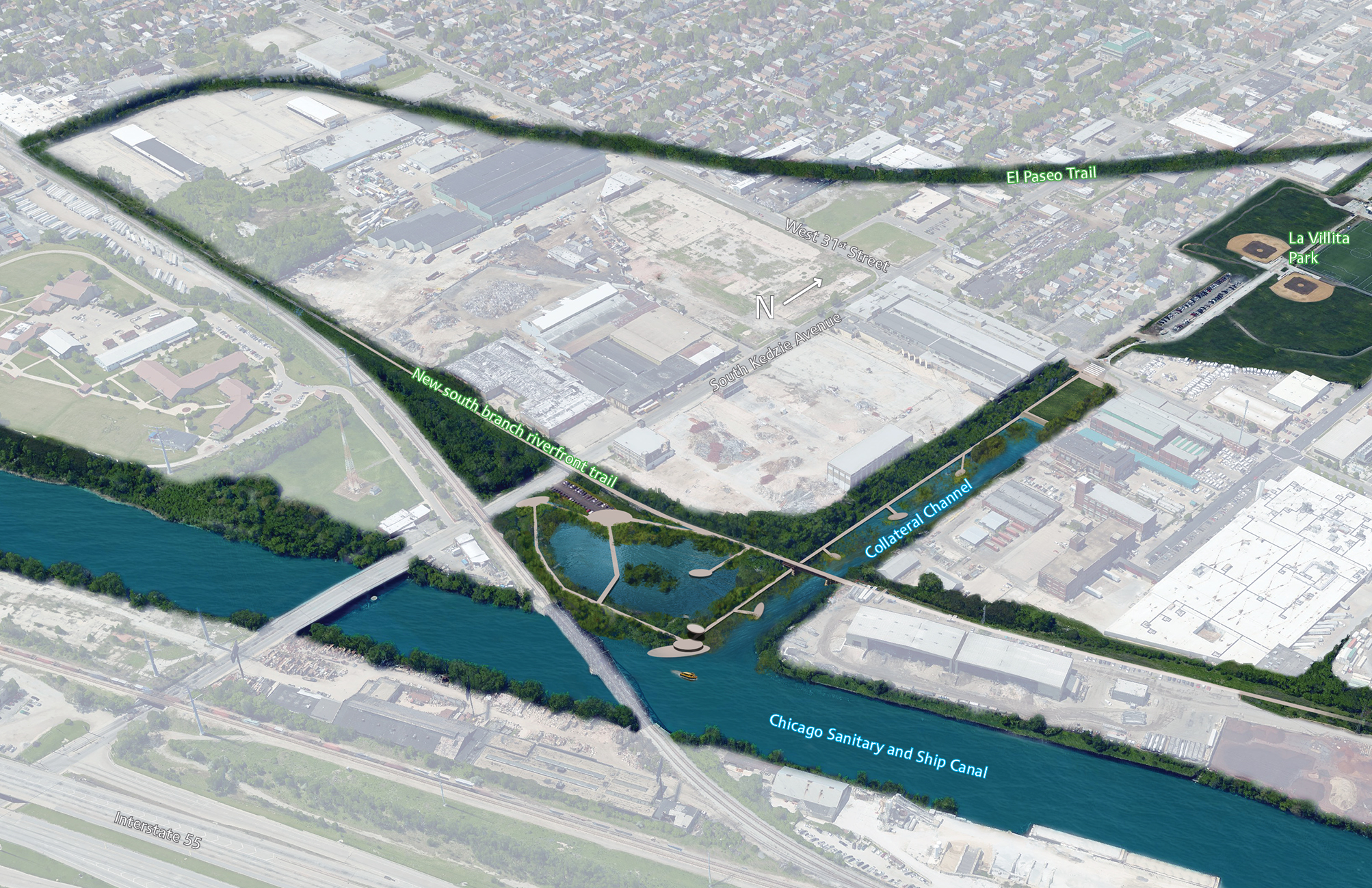
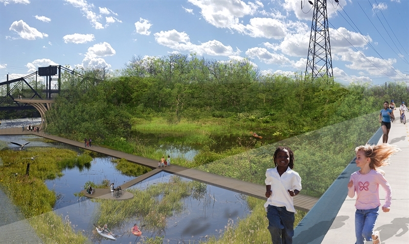
Collateral Channel
Ross Barney Architects
Improvements at La Villita Park and El Paseo create a unique opportunity to activate the now-stagnant Collateral Channel as green space and a waterway to connect residents to the river.
Ross Barney Architects
Green space on the Collateral Channel will create a new connection to La Villita Park and El Paseo
For residents today in Little Village, the Collateral Channel is notorious for its odor, rather than its potential as an inviting riverfront. By addressing odor issues and creating open space for recreation like family picnics, the Collateral Channel could become a major hub of riverfront use that would connect the community to their river and adjacent park and trail amenities.
Ross Barney Architects
Creating flow in the channel will address odor and promote aquatic life
The Collateral Channel of the future could be one of better water quality, healthy wetlands and thriving ecosystems. It could be the principal access point to the Chicago Sanitary and Ship Canal for both boats and riverfront trail users.
Back to top
Goose Island
Ross Barney Architects
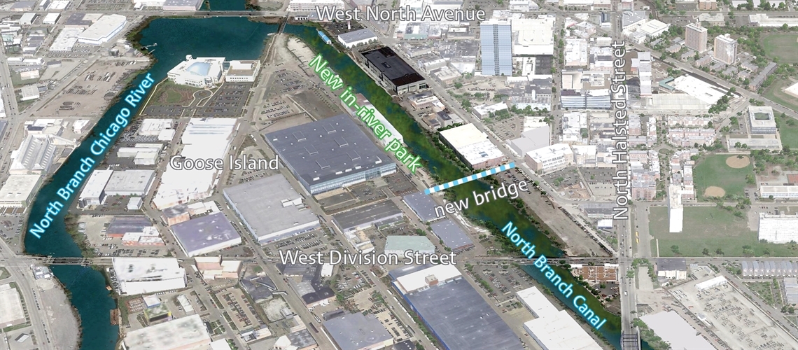
New bridges and a wetland park in the river could unite Goose Island to the bustling retail and residential district to its east.
Ross Barney Architects
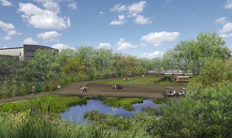
A non-navigable channel could become a wetland park and natural playground
Along the southwestern bank of the Chicago River sits the shallow North Branch Canal, which is off-limits to large barges and boats. With the right mix of tough and attractive native plant species, the channel could support a thriving, biodiverse wetland with migratory birds, waterfowl and turtles.
This stretch of water that forms the east side of Goose Island would be an ideal spot for novice and expert kayakers, fisherman and birdwatchers alike seeking a quiet, natural playground for recreating on the river.
Enhanced pedestrian, bike and transit accessibility could move people to and through Goose Island
From North Avenue to Division Street, there is ample opportunity to create better access for the residents, retail and office workers around Goose Island to more easily cross the channel and connect to surrounding transit and riverfront amenities. A pedestrian and bike-friendly bridge, clearly marked access points and new river-facing development similar to the existing riverwalk at Whole Foods could invite people in.
Back to top
Riverdale
Ross Barney Architects
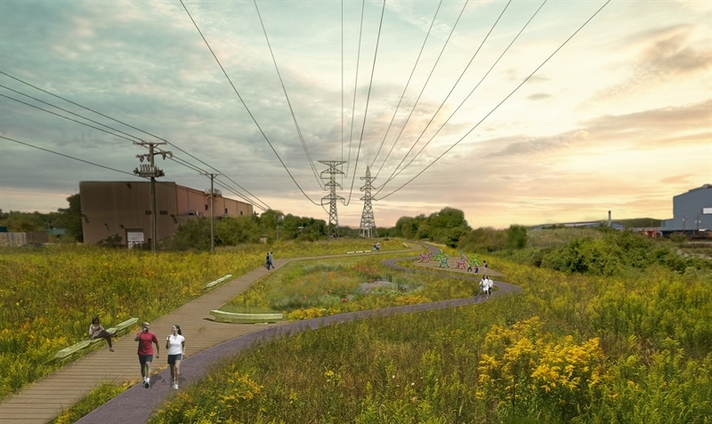
The Calumet River could form the missing link between residents, rivers, forest preserves, bike trails and jobs—and unite Chicago and neighboring suburban communities.
Ross Barney Architects
Ross Barney Architects
Activating Lake Riverdale will create an inviting, thriving natural area
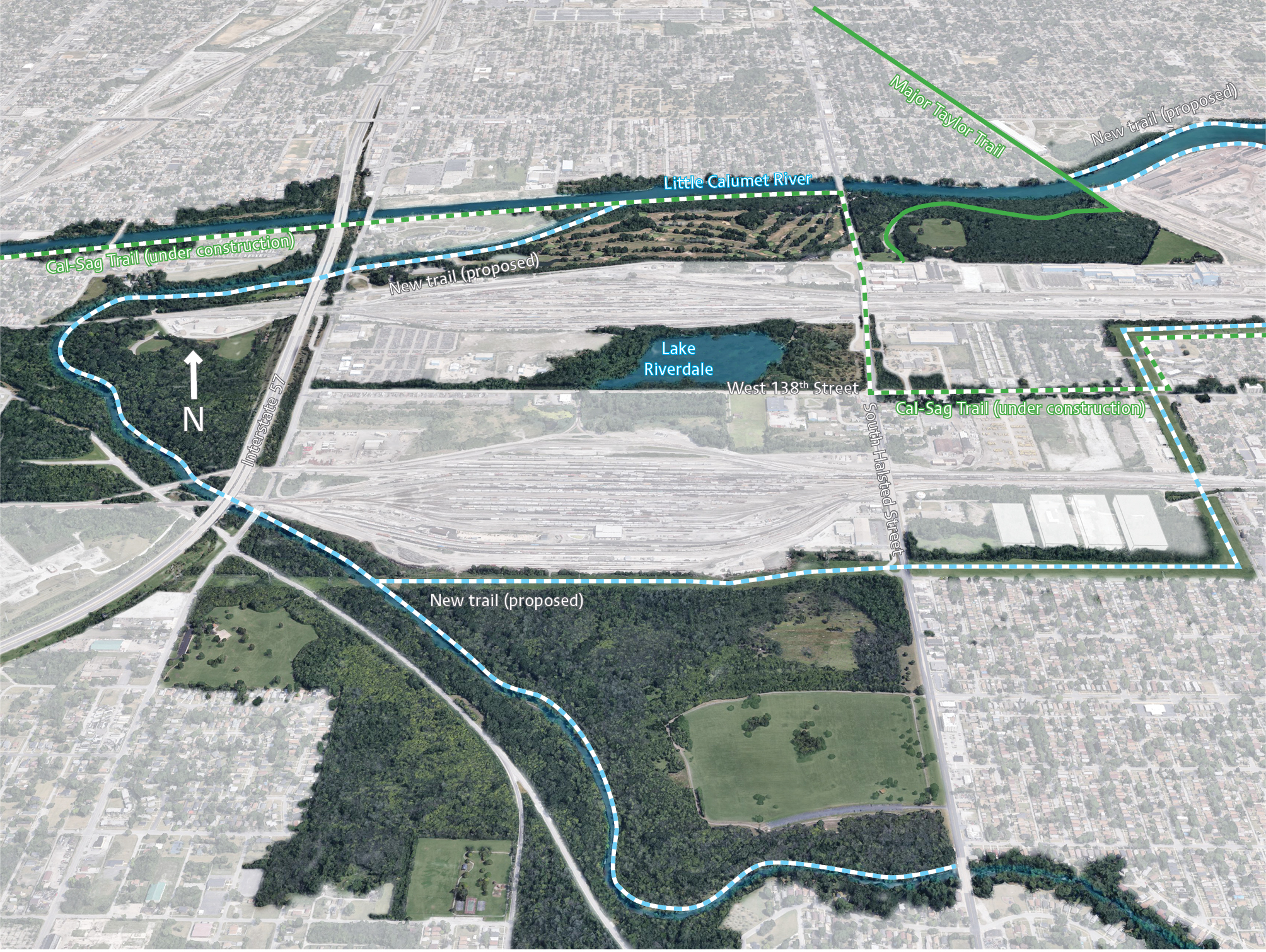
Just north of 138th Street between Halsted Street and Ashland Avenue is Lake Riverdale, largely out of sight and reach to residents. This open marsh could be restored to ecological health to provide ecosystem services such as managing stormwater and alleviating the urban flooding incidents in the area.
Imagine a healthy, living marsh that welcomes residents to stop by and enjoy the outdoors. Lake Riverdale could become another active and vibrant point of recreation with the other rich natural assets and forest preserves existing amidst the Riverdale industrial corridor.
Moving people to and through the Calumet River system will connect people, places and nature
Activating open spaces like the dormant land under ComEd power lines could enhance an emerging network of trails in Riverdale along with the Major Taylor Trail, Cal-Sag Trail and Burnham Greenway, where the Little Calumet River system becomes a transportation amenity instead of a barrier.
By improving street grid connections, signage and wayfinding, the Calumet River and riverfront trails could connect people, places and employment opportunities for the residents and workers in the Village of Riverdale. Neighbors in Blue Island, Chicago (including Altgeld Gardens), Calumet Park, Dixmoor and Dolton would also benefit.
Back to top